Lambaréné
Lambaréné is based in the Central African Rainforest at the river Ogooué. This river divides the city into 3 districts: Rive Gauche, Ile Lambaréné and Rive Droite. The Albert Schweitzer Hospital and the districts Adouma and Abongo are located on Rive Droite. The districts Atongowanga, Sahoty, Dakar, Grand Village, Château, Lalala and Bordamur build the Ile Lambaréné. The majority of the people in Lambaréné live in the district Isaac located on Rive Gauche. This district hosts the Lambaréné Airport.
Today Lambaréné is inhabited mainly by Bantu ethnic groups such as the Fang, Bapounou, Eshira, and Myéné; these displaced the Pygmies to the east and north of Gabon. The main economic activity in the town is the fishery and a new port is under construction.
The Franco-German Nobel Peace Prize winner Albert Schweitzer (1875–1965) founded his hospital in Lambaréné in 1913. Today, the Hôpital Albert Schweitzer comprises departments of Internal Medicine, Surgery, Paediatrics, a maternity clinic, a dentistry clinic and since 1981 a Medical Research Unit, which focuses on malaria research.
Map - Lambaréné
Map
Country - Gabon
 |
 |
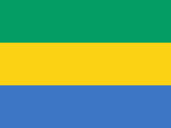
| Flag of Gabon | |
Since its independence from France in 1960, the sovereign state of Gabon has had three presidents. In the 1990s, it introduced a multi-party system and a democratic constitution that aimed for a more transparent electoral process and reformed some governmental institutions. Despite this, the Gabonese Democratic Party (PDG) remains the dominant party. With petroleum and foreign private investment, it has the fourth highest HDI in the region (after Mauritius, Seychelles and South Africa) and the fifth highest GDP per capita (PPP) in all of Africa (after Seychelles, Mauritius, Equatorial Guinea and Botswana). Its GDP grew by more than 6% per year from 2010 to 2012.
Currency / Language
| ISO | Currency | Symbol | Significant figures |
|---|---|---|---|
| XAF | Central African CFA franc | Fr | 0 |
| ISO | Language |
|---|---|
| FR | French language |


